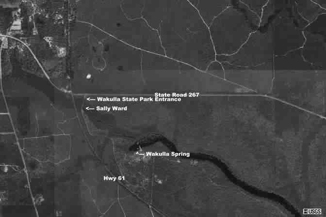
Location:
Wakulla Springs is about 14 miles south of Tallahassee.
From the intersection of State Road 267, drive 1.2 miles southeast on State
Hwy 61 to the entrance.
Description:
Wakulla Springs is the centerpiece of the state
park with swimming, natural trails, and glass bottom boat tours. The cave
system is one of the most extensive in the United States and the subject
of numerous research projects. Mastodon bones and skulls, as well as numerous
other historical finds, have been recovered from it's depths. Swimming
is not allowed above the headspring, but the tour boats travel directly
over the cavern offering an awesome view of the blue void. The research
teams of the USDCT (United States Deep
Cave Diving Team) and the WKPP (Woodville
Karst Plain Project) have done the most work here. Most of the maps
below are from the USDCT's 1987 project, but new information from this
year's project should hopefully be released soon. The USDCT used several
electronic devices, such as radio beacons to find the surface location
of particular locations in the cave, to aid in ensuring the accuracy of
their maps. The WKPP is also involved in other sites of the local karst
plain. Check out the GUE website, here,
for some excellent information of the entire area written by the hydrogeololgist
of the WKPP. Wakulla Springs State park also incorporates Sally Ward spring
(located near the front of the park).
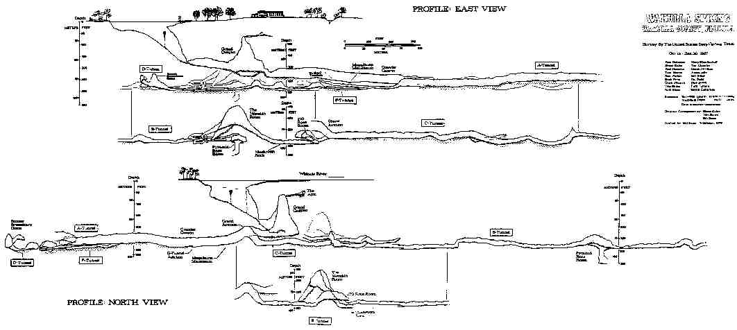
Click here for Wakulla Springs cave profile
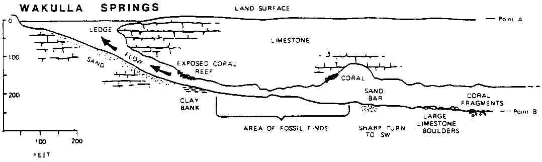
Click here for Wakulla Springs cave overview
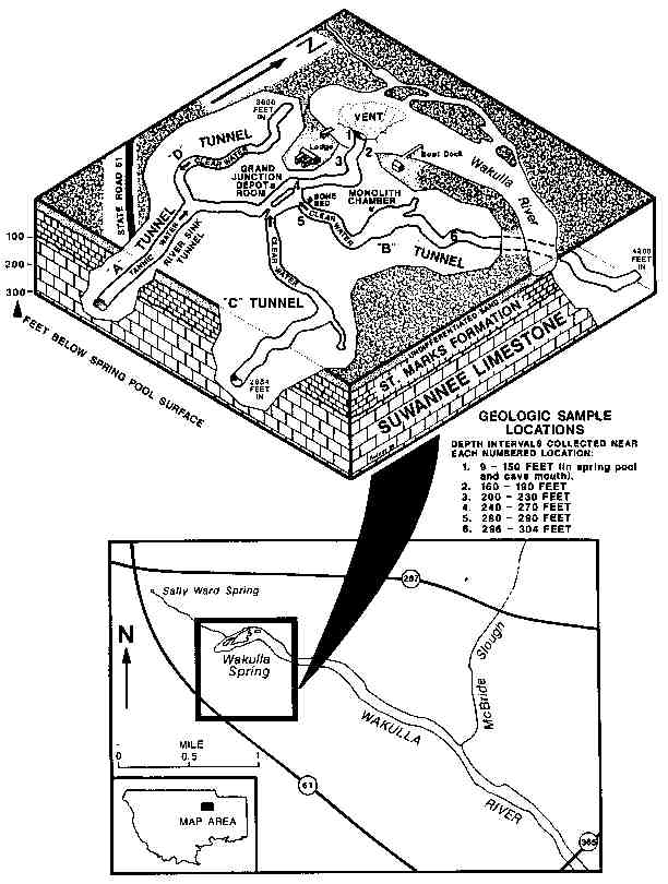
Click here for Wakulla Springs cavern map
Click here for Wakulla Springs survey
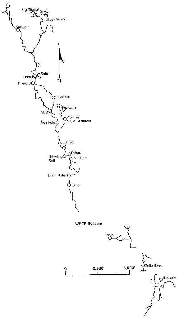
Click here for Woodville Karst Plain stick
map
Click here for Wakulla aerial
Click
here for Wakulla Springs State Park website
Return to Florida Cave, Caverns, and Sinkholes