Floridacaves.com
Cave, Cavern, and Sinkhole Diving
Most of the technical information about the springs has come from the Florida Geological Survey Bulletin #31. This resource was written in the late 1970s and may not current. In October 2016, this document was revised and released as Florida Geological survey Bulletin #66. You can download the entire document for free by visiting the website. I have tried to post most of the maps that I have of the various system. The maps show some of the dedication of other divers to accumulate and share information with the community. Their exploration efforts have helped the sport tremendously and shows the kind of camaraderie that attracted me to diving in the first place. I did not make any of the maps that you see here nor will I ever try to profit from their works. Some of the maps to certain sites have been password protected from printing.
If there are any comments, concerns, complaints, or suggestions, please let me know so that I may refine the page. Where other sites give better, additional, or more complete information about a site, I will try to provide a link. I am hoping to provide the reader with a bit more knowledge of dive sites (both OW and cave) in general. There are too many great pages on gear rigging, training, and dive style for me to even attempt to duplicate their efforts. This page cannot grow without the information from the community. Please send any site descriptions, pictures, or maps that would be of interest; especially for sites that I do not yet have information.
Now, on to the info.
| Disclaimer: The material presented in the page is provided for educational and informational purposes only. Reading any of this does NOT qualify you to dive these sites. Many sites have low visibility, restrictions, and silt that challenge the most advanced diver. Please obtain the proper training from one of the certifying organizations, like TDI, IANTD, NSS-CDS or GUE, before attempting this kind of diving. If Murphy doesn't get you, Darwin will. |
Many of the pages have pictures and maps that may take a while to load. I've tried to keep everything small in order to reduce web space and download time, however resolution often suffers as a result. If you are looking for information about simple open water spots I suggest the book "Ned Deloach's Diving Guide to Underwater Florida", also available at your local dive shop. Most of these sites listed on this web site are shore or inland dives and many are on private or posted property. Please be sure to ask the owners for permission before diving. Some sites are open only to permitted persons or groups or are on the verge of being closed. Some good sites have already been closed completely due to liability concerns, trash, or property damage (usually caused by local non-divers). If you choose to dive the sites, please respect the rights of others. You may not want to dive the site again, but your behavior can close it off to everybody else.
| The following key will help you know what
is listed before going to the page.
cave: This site contains passages that are completely underwater. Only experienced and fully certified cave divers [TDI, IANTD, NSS-CDS or GUE] should attempt this site. These maps are purely informational and here to provide a general idea of the system's footprint. If you use them solely to plan your dive, then you have no business in the cave in the first place. cavern: There is a discernible cavern open enough for those certified for cavern diving. At night, any cavern becomes a cave because there is no longer the sun to light the entrance. All dives should end WELL before ambient light becomes dim and the maximum depth for cavern diving is 70 feet. Starting visibility should not be less than 40 feet and there may be no restrictions that do not allow two divers to swim abreast of each other. map: There is a survey or simple map of this site. closed: Access to this dive site is closed, guided, posted, or severely limited by normal means. Guided dives require the presence of someone whom is experienced and very familiar with the site. OW: Certified open water divers may dive this site. Beware, the depths can exceed recreational limits at some locations. |
Florida Cavern and Cave Dive Sites
| Alachua Sink - Alachua County (cave, guided, map) | Isabella Spring (Black Hole) - Pasco County (cave, map) |
| Amberjack Hole - Gulf of Mexico (map) | Jackson Blue Springs - Jackson County (cavern, cave) |
| Anderson Spring - Suwannee County (cave) | |
| Apopka Blue Sink - Orange County (map) | Jug Spring - Columbia County (cave, map) |
| Arch Sink - Pasco County (cavern, cave, map) | Jewel - Hudson (cave) |
| Beacon Woods - Hudson (cave) | Joe's Sink (aka Joe and Mary's) - Hernando County (cavern, cave) |
| Big Dismal Sink - Woodville Karst Plain (cave, map, closed) | King's Spring - Crystal River (OW, cavern) |
| Blue Grotto - Williston (OW, cavern, map) | Knight's Sink - Tarpon Springs (cave, closed, map) |
| Blue Sink - Pinellas County (closed) | Last Spring - Hillsborough County (cave, map) |
| Blue Springs State Park - (OW, cavern, map) | Leon Sinks Cave - Leon County (cave, closed, map) |
| Buford Spring - Hernando County (cave, map) | Lineater Spring Cave - Suwannee River (cave, map) |
| Bonnet Spring - Suwannee County (cave, guided, map) | Little Blue Sink - Hillsborough County (OW, closed) |
| Cathedral Canyon Cave - Suwannee County (cave, map, semi-closed) | Little Dismal - Leon County (map, cave, closed) |
| Cheryl Sink- Leon County (cave, map, closed) | Little River - Suwannee County (cave, cavern, map, closed) |
| Chicken Farm Sink - Hillsborough County (OW, closed) | Little Salt Sink - Sarasota County (map, closed) |
| Church Sink Cave - Leon County (cave, map) | Little Salt Spring - Hernando County (cave, map) |
| Coleman Sink - (map) | Lolly Sink (aka Nemesis) - Hudson (cave, closed) |
| Convict Springs - Lafayette County (cave, map, closed) | Lost Forty - Hernando County (cave) |
| Cow Spring - Suwannee County (cave, map, semi-closed) | Madison Blue Springs - Madison County (cavern, cave, map) |
| Crystal Beach Spring - Crystal Beach (cave, map) | Manatee Springs - Levy County (OW, cavern, cave, map) |
| Crystal River Springs - Crystal River (OW, cavern, map) | Matthew's Sink - Levy County (cave, closed) |
| Crystal Springs - Pasco County (closed) | McBride's Slough Spring Cave - Wakulla County (cave, map) |
| Devils Den - Williston (OW, cavern) | Morrison Springs - Walton County (cavern, map) |
| Devil's Sink - Hawthorne (OW, cavern) | Mystery Sink - Winter Park (map, closed) |
| Devil's Ear/Eye System - Gilchrist County (OW, cavern, cave, map) | Naples Sink - Gulf of Mexico (map) |
| Diepolder II & II - Hernando County (cave, map, closed) | Nexxus - Hudson (cave) |
| Dogwood Spring - Gilchrist County (cave, map) | Palm Sink - Hudson |
| Double Keyhole - Hudson | Paradise Springs - Ocala (OW, cavern, map) |
| Double Spring - Hillsborough County (cave, map) | Peacock Springs - Suwannee County (cavern, cave, map) |
| Eagle's Nest (Lost Sink) - Hernando County (cave, map) | Rainbow River - Dunnellon (OW) |
| Edward's Sink - Live Oak (cave, map) | Rock Bluff Spring - Gilchrist County (cave, map, closed) |
| Emerald Sink - Wakulla County (cave, map, closed) | Rock Sink - Port Richey - (OW) |
| Fanning Springs - Fanning (OW) | Round Sink - Hudson (cavern, cave) |
| Forty Fathom Grotto (OW, map) | Sally Ward Spring - Wakulla County (cave, closed, map) |
| Garden World Sink - Hudson (OW, closed) | Salt Spring - Pasco County (cave, map) |
| Ginnie (Jenny) Springs - Gilchrist County (OW, cavern, cave, map) | Silver Glen Spring - Marion County (cave, map) |
| Gordneck Sink - Orange County (cave, map) | Sullivan Sink Cave - (closed, map) |
| Green Banana Sink- Gulf of Mexico (map) | Sulphur Springs - Tampa (cave, closed) |
| Green Dolphin Sink - Tarpon Springs | Suwanacoochee Cave - Madison County (cave, map) |
| Green/Snake Sinks Cave - Lafayette County (cave, map) | Telford Springs - Suwannee County (cavern, cave, map) |
| Hart Springs - Gilchrest County (cave, guided) | Troy Springs - Lafayette County (OW, cavern) |
| Health Spring (aka Wall Spring) - Palm Harbor (cave, closed) | Twin Caves - Jackson County (cave, map) |
| Hidden Lake Sink - Tarpon Spring | Twin D's - Hernando County - (cave, closed) |
| Hole in the Wall - Jackson County (cave, map, closed) | Tarpon Bayou Sink - Tarpon Springs (cave) |
| Hospital Hole - Hernando County (OW) | Vortex Spring - Holmes County (OW, cavern) |
| Hornsby Springs - Alachua County (cave, map) | Wakulla Springs - Wakulla County (cave, map, closed) |
| Horseshoe Springs - Hudson | Ward's Sink - Pasco County (OW, map, closed) |
| Howard Park - Tarpon Springs (cave, map) | Warm Mineral Springs - Sarasota County (OW, closed, map) |
| Hudson Grotto - Hudson (OW) | Wayne's World - Hudson (cave, map) |
| Indian Springs - Wakulla County (cave, closed) | Weeki Wachee Springs - Hernando County (OW, cavern, cave) |
| Innisfree Sink - Wakulla (cave, map, closed) |
If you have any question or additional
information, please e-mail me.
info@dayo.com
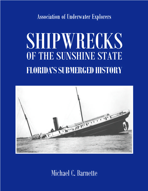
For those interested in wreck diving, I highly recommend the new book 'Shipwrecks of the Sunshine State: Florida's Submerged History' by Michael Barnette. This is a great book that is incredibly detailed and researched in the historical accountings of so many of Florida's natural (real) wrecks. Besides being carried by Florida area Barnes & Nobles, you may also order it directly from the author at his website: http://uwex.us/shipwreckbook.htm